


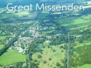
This lesson is part of a wider Geography unit called Great Missenden – A Village Settlement which is designed for students in upper KS2 (Y4-6).
In this lesson, students are introduced a high street survey, a great way of looking at land use in settlements. The presentation first outlines the RICEPOTS system for categorising land use and includes many photos of real world examples to aid understanding.
The activity challenges students to use Google Street View to work out the types of land use on Great Missenden High Street. It is differentiated three ways:
Easier – Students find the business name/land use of 10 places on Great Missenden High Street (with clues).
Medium – Students find the business name/land use of 14 places on Great Missenden High Street (with clues).
Harder – Students find the business name/land use of 14 places on Great Missenden High Street (no clues).
Extension – Students use Google Street View to survey a section of Great Missenden High Street by themselves.
If you like this resource, please review it. We will happily send you a free resource of your choice in return for useful feedback. Contact us at ed@teachitforward.co.uk.
Reviews
There are no reviews yet.